The best time to travel in Ecuador, Peru and Bolivia
Weather and climate zones in Ecuador, Peru and Bolivia
At Fairtravel4u we often get the question: “What is the best time of the year to travel to Peru, Bolivia or Ecuador?”
However, to be able to answer this question correctly we need to know what type of holiday you’re looking for and where exactly you want to go?
In general the raining season in Ecuador, Peru and Bolivia is considered to run between December and May. But because of the extreme differences in altitude (between sea level and 6768 m at the top of the Huascarán Mountain) and geological differences in these countries, they consist of many different climate zones.
However raining season can make traveling more challenging it isn’t always the worst season to visit Ecuador, Peru or Boliviaand sometime the weather is even better. Let us explain:
Best time and weather to travel in Ecuador
 Ecuador is located right on the Equator and because of this there isn’t much variation in temperature during the year. The two main seasons in Ecuador are therefore not based on temperature, but more on chance of rain.
The wet season is from December till May. In contradiction to the fact that most of Ecuador is located on the Southern Hemisphere, this season is considered winter in Ecuador.
The dry season or summer is from June until November. During these months there can still be rainy days, but less than during the raining season.
Because of its geographical location and landscape Ecuador has many different micro climates therefor it can occur that you only have to travel less than 50 km to arrive in a very different environment.
The four mayor climate zones in Ecuador include: the Pacific coast, the highlands, the Amazon and the Galapagos Islands (which are located more than 990 km from the mainland).
The climate at the Ecuadorian coast
The Pacific Coast has a humid climate all year round. From December till April there are regular rain showers, but you can also encounter clear blue skies. The temperature during the day can be between 22 and 33 degrees Celsius.
From April till November the temperature drops a few degrees. There is a very low chance for rain, but there are also fewer sunny days. Most days will start foggy and maybe even stay the whole day like that. This fog is locally called Garua.
The climate in the Ecuadorian Highlands
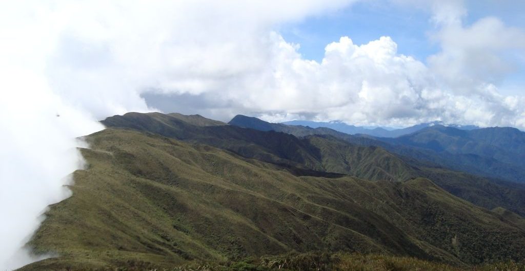
The day-time difference of temperature in the highlands can be extreme between 0°C and 18°C year round. The temperature depends a lot on time of the day, altitude, sunlight and the wind. When it is sunny and there is no wind you can be walking at 4000 meter altitude in shorts and T-shirt and still feel comfortable. When wind and rain replace the sun, the temperature drops quickly below the 7°C but feels even colder.
Although the seasons in the Andes are not very clear and seem to vary even more because of the climate changes, usually the wettest months are: October, February, March and April. During raining season it isn’t uncommon that roads get temporarily blocked by small landslides.
The climate in the Ecuadorian Amazon
The climate in the Amazon is humid and warm year round. The temperature during the day is usually between 26 °C to 38 °C with a humidity of more than 90%. However be careful that after a bright and sunny day the temperature in the evening can drop quickly until below 20 °C and make the evening feel cool. The humidity is something to keep in account as it affects everything in the Amazon. It is recommendable to keep electronics and clothes you don’t use in sealed plastic bags to prevent them from getting humid/ wet.
Although the official raining season for the Amazon region in Ecuador is also between November and April, the unique geological location of the Cuyabeno Amazon Reserve actually causes December and January to be the two driest months of the year.
Because of the drought during these months it isn’t always possible to reach each location by canoe. On the positive side, more animals will be drawn to the fewer places with water, which can be better for wildlife spotting.
More information about the climate in the Ecuadorian Amazon.
The climate at the Galapagos Islands
 These unique islands are located around 990 km from the Ecuadorian coast and although their climate is similar to the main coastal line of Ecuador there are some important things to keep in mind.
The climate on the Galapagos Islands is also influenced by no less than 4 ocean currents, including the South Equatorial Current, the Cromwell Current, the Panama Current and the famous Humboldt Current.
From June to December, the cold Humboldt Current from Antarctica and the warm Equatorial Current from the north meet on the islands’ shores where they create a cool and misty season known as la Garua. The coolest and foggiest months start from July through October. July and August also have the windiest days with bigger waves as a result. Peculiarly July and August are the busiest two months in tourism.
By January, the Humboldt current weakens and trade winds from the southeast prevail, allowing a return of the warmer waters from the equatorial current and a more “tropical” climate. Warm, humid and rainy weather, particularly afternoon downpours, can occur from January through March. Underwater visibility is at its best during this time. However when the water gets colder and the visibility gets less, it also means that there is more food in the water, which attracts bigger fish and even the Humboldt Wales (from June till August)!
So basically each weather station has its advantages.
For more information about the climate on the Galapagos Islands.
The best time and weather to travel in Peru
Because of its size and geographical landscape the weather in Peru also contains many different micro climate zones with each its own characteristics. However in general you can split Peru in longitude in three different climate zones: the coastal desert (11% of Peru), the Andean Higlands (30%) and the Amazon (59% of Peru).
More detailed information you can find at: Climate in Peru and Travel Peru.
The climate at the Pacific Coast of Peru
 The Peruvian coastline is around 2400 km long. This climate zone roughly consists of a narrow stretch of desert (between 20 km to 100 km wide) as an extension of the Atacama Desert in Chile.
Just as in Ecuador the Peruvian coast has a humid climate all year round and the wind often blows from south to north. The temperature during the day can be between 18 and 30 degrees Celsius. The further south you go, the fewer rain you get, but also lower temperatures. Mancora tend to have a comfortable temperature year round, because right at this spot the Humboldt Current touches the Pacific coast
Between December and April there can be short rain showers, but in general not as bad as in Ecuador. However there is less rain, the north of Peru and especially in Piura and Mancora tend to have a higher risk for getting bitten by mosquitos that carry Dengue.
December, January, February and March are the best months to encounter clear skies with sunny days and beautiful sunsets.
April is known to be a foggy month with most flight cancelations between Trujillo and Lima.
From April till November the temperature drops a few degrees, there will be almost no rain, but also fewer sunny days. The weather is often cloudy or even foggy, especially Lima is known for receiving little sunlight between April till November.
El Niño
The El Niño phenomenon used to occur more or less once every 7 year around Christmas (that’s why El Niño was named after the arrival of baby Jesus). But climate changes seem to have changed this Schedule and in March 2016 a special “El Niño Costero” caused the worst floods in over 20 years at the coast of Peru.
El Niño, La Niña and El Niño Costero are all caused by unusual warm ocean currents (above 27°C). Depending on their location in the Pacific Ocean they cause more rain at the coast or in the highlands.
The climate in the Andean Highlands of Peru
 Dry season in the highlands of Peru runs more or less from May until November. The temperature during the day depends a lot on your altitude and the presence of sun and wind. On sunny days without wind the temperature above 4000 meter altitude can still reach the 18°C and it will be no problem to walk around in a T-shirt. It is important that you do use sufficient protection against the stronger radiation of the sun at high altitude. If you don’t have a lot of hair it is also recommendable to wear a hat.
Be aware that the climate at high altitude can change quickly when the sun goes away and the wind comes up. When this happens you will need a warm jacked and maybe even a hat to stay warm.
During the night and in the early morning the temperature often gets below 0°C.
Raining season in the highlands of Peru is more or less from December until April. The temperature during these months is slightly higher, but if you want to go hiking in Huaraz, or along one of the Inca Trails then be well prepared for rain.
The climate in the Peruvian Amazon
The climate in the Amazon Rainforest of Peru is year round humid (90%), wet and warm with temperatures between 28°C and 38°C during the day. Be prepared that after a clear hot day of 38°C a temperature of 18°C in the evening can feel cool.
Although the rainforest is always wet, there are differences between the raining season and the so called dry season in the Amazon. Dry season is generally from May until November. During these months the temperature is slightly lower (24°C / 32°C) and the rain showers are less frequent and heavy. Between May till August it is possible that the temperature in the south of the Amazon even reaches the low ten’s. This phenomenon is called ‘friajes’ and seems to be a good time to spot the jaguar.
During the wet season and especially between January and April it is important to keep in mind that traveling to and within the Amazon can be more challenging. Heavy rains and rising rivers frequently cause roads to be temporarily impassible. Also flights to and from the Amazon region are frequently delayed or sometimes even cancelled due to heavy rain showers.
The best time and weather to travel in Bolivia
Although Bolivia has no coastline like Ecuador and Peru, the geography and huge altitude differences still provide this country with many different climate zones. The highest point in Bolivia is the snowcapped Nevado Sajama 6,542 m (21,463 ft) and its lowest point the Paraguay River in the Amazon at 90 m above sea level. For more detailed information about the climate in Bolivia.
The climate in the Andean highlands of Bolivia
 Most tourists who travel to Bolivia only visit its famous Altiplano. The Altiplano translates in ‘high flat’ and refers to a huge relative flat landscape roughly at an altitude of 3600 m to 4000 m between Puno in Peru and the Salar de Uyuni in Bolivia. The average temperature year round is somewhere between -1°C before sunrise till 15°C just after midday on a sunny day. Raining/ snow season is between November and March. If you want to experience the Salar de Uyuni turned into a gigantic mirror, reflecting the sky, then January is generally the best month. Although this phenomenon is spectacular, do be aware that most pictures on social media and in tour brochures are modified to look even prettier. Another downside can be that when there is too much water on the salt flat, tours will not be able to reach the surrealistic cacti island called Inca Wasi.
June and July are the coldest months in the Altiplano and the temperature during the 3 day Salar de Uyuni Tour can reach below -14°C at Laguna Colorada (4200 m) just before sunrise!
The climate in the Bolivian Amazon
The climate in the Amazon Rainforest of Bolivia is similar to this in Peru, year round warm, wet and humid with a temperature between 32°C during the day to 18°C at night. The highest temperature ever registered in Bolivia was in the Chaco Amazon district east of Tarija at 47°C!
During raining season the temperature is slightly warmer and there is less difference between day and night temperatures. Raining season is worst during the months December, January, February and March. During these months traveling to and within the Amazon region is much more challenging.

