Amazon Jungle Info
This post provides you with more information about the western Amazon Rainforest, including:
- Madidi National Park
- Beni Biosphere Reserve and Serere Sanctuary in Bolivia
- Pacaya Samiria National Reserve, close to Iquitos, Peru
- Manu (Biosphere) Reserve
- Tambopata Candamo Reserve and Bahuaja-Sonene National Park in Peru
- Cuyabeno Wildlife Reserve and Yasuni National Park in Ecuador
Madidi National Park
 Was created in 1995. Officially The PN (Parque Nacional) and IMNA (Integrated Management Natural Area) Madidi covers 18,957.5 km2 (1,895,740 ha, or 4,5000,000 acres) of which 12,715 km² come under the heading of National Park and 6,242.5 km² are categorized under the Integrated Management Natural Area. This area ranges from the Amazonian lowlands of the rivers Heath and Tuichi, at 200 m altitude, to the mountains of the glacier-covered Apolobamba Range at more than 6,000 m altitud. Madidi’s vast wilderness encompasses unparalleled biodiversity ranging from montain cloudforest to dry tropical forest, humid lowland forest to savanna, wild rivers and lakes.
Its registrated boundaries are between 12° 30′ and 14° 44′ southern latitude and between 67° 30′ and 69° 51′ western longitude. The area under conservation covers an altitudinal gradient ranging from 180 to 5,760 meters above sea level and has a variety of ecosystems.
Madidi’s mountains, forests and river habitats are home to more than 1,000 species of neotropical birds, 5,000 – 6,000 superior plants, 44% of all new world species of mammals, and an estimated 38% of neotropical amphibians. The tropical Andes, where Madidi is located, is also a globally critical hotspot of plant endemism. Inside the park’s limits is found the community of San Jose de Uchupiamonas, of the Quechua-Tacana ethnic group.
The ecosystems are protected in three reserves – Madidi National Park (Amazon rainforest, incl. the Yungas and montande dry forest), Pilon Lajas Biosphere Reserve and Indigenous Territory (Amazon rainforest) and the Pampas Reserve (Beni savannas).
The region forms part of the international corridor of protected areas that extends from Vilcabamba (in Peru) to Amboro (in Bolivia), including Manu Biosphere Reserve, Tambopata-Candamo Reserve, Bahuaja-Stonene National Park y Manuripi-Heath, Apolobamba. All together this forms one of the largest protected areas and most biologically diverse regions in the world.
Location:
The PN (Parque Nacional) Madidi is located in the Northwest region of the Department of La Paz, in the provinces Franz Tamayo, Iturralde and Abel Bautista Saavedra and can be reached from Rurrenabaque if you cross the Beni River with the small passenger ferry over to San Buenaventura.
Wildlife:
Dr. Robert Wallace, wildlife biologist, is credited for discovering in Madidi an unidentified titi monkey who only lives in Madidi, a new species to science. The right to name the new species was auctioned through an agreement between the scientists, the Bolivian National Protected Area Service (SERNAP) and the Foundation for the Development of the Protected Areas (FUNDESNAP). This effort has raised 650,000U$ for a trust fund which now generates enough income to pay for 14 park guards annually. The park is also notable for its over 1,000 bird species, representing 11% of the world’s 9,000 bird species.
Equivalent there is a rich and varied life in the water with many fish species.
Note: At a recent survey in October 2011 done with the support of National Geographic they discovered 19 different jaguars in the Madidi reserve!
 The local people who have migrated here from the Andean highlands speak the Quechua language. The cultures who find their origin here include the Tacana, the Mosete, the Tsimane and the Ese Ejja, all of which have their own language which pertains to one language group. Several of them have joined forces to protect their natural habitat. Their projects include: on the eastern border, the TCO (Tierra Comunitaria de Origen / Indigenous community land) Tacana I, on the north side of the park, TCO Tacana II and south adjacent to the Integrated Management Natural Area National Apolobamba, TCO Lecos Apolo, TCO Lecos Larecaja and the Biosphere Reserve and Indigenous Territory Pilón Lajas.
There are also some eco-lodges in and around the Madidi National Park. The oldest and best known is Chalalan Ecolodge in Chalalán on the Tuichi River, a successful community-based enterprise that generates significant economic benefits to indigenous communities.
Another important site is the Serere Sanctuary operated by Madidi Travel; a 4000 hectare private reserve dedicated to generating income through real sustainable eco-tourism for on-going conservation work to establish new legally protected zones in the north of the Madidi Mosaic. It’s creator Rosa Maria Ruiz is a woman who has fought for the Madidi Park and its conservation for over 20 years. She was the founder of Eco-Bolivia, an organization that was instrumental in establishing Madidi National Park in the 1990s. The Serere lodge is located three hours from Rurrenabaque by boat.
Others lodges include San Miguel del Bala Eco-Lodge on the banks of the Beni River reached by boat 40 minutes up stream from Rurrenabaque, and the young Entno Ecolodge – Mashaquipe on the Tuichi River close to the outlet into the Beni River.
The Weather:
The climate varies from cold in the mountain range area, in temperate lands intermediate mountain until warm lowlands of the North.
The winds come predominantly from the north and south of cold fronts have little impact on the temperature of the region’s Madidi. The dry season coincides with the austral winter. The average annual temperature is 26 C degrees , but much depends on the altitude.
Madidi is located in the southern hemisphere and so the cold season (autumn and winter) go from May to September and the hot seasons (spring and summer) from October to the beginning of April, it’s also considered the rainy season. Warmest month November, wettest month January.
 Neutral information from a visitor in 2011:
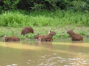
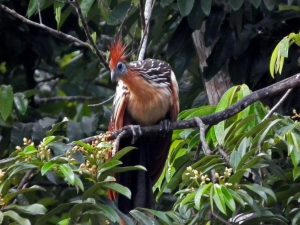
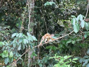
Wildlife viewing opportunities are good. You’re likely to see (or hear) howler monkeys, toucans, macaws, hoatzins and caiman. On a three day stay in the park Mr. T viewed a plethora of birds and insects; he also saw tayra, white-lipped peccary, capybara, common squirrel monkey, brown capuchin monkey, dusky titi monkey (unique to Madidi, and recently named as a new species – rare to see), long nosed bat, spectacled caiman, giant gladiator frog.
Beni Biosphere Reserve
The Beni Biosphere Reserve covers a geographical area of 135,000 hectares. Its incredible ecological composition caught the attention of national and foreign researchers and environmentalists who for more than ten years, with the sponsorship of the Bolivian Academy of Sciences, have joined efforts to have it recognized as a protected area. This is not only due to its rich biota, but also to the presence of an important indigenous Amazonian group, the T’simane. It was declared a Biosphere Reserve in 1986 by the MAB-UNESCO International Council with the purpose of promoting conservation in a context of balance between humans and nature. 30,000 hectares have been legally recognized by the Bolivian State as part of the T’simane Indigenous Territory.
Among the natural virtues of the Biosphere Reserve is the convergence of three biogeographical zones: the Amazon, the Chaco and the Cerrado. Studies carried out in the area demonstrate the presence of more than 100 species of mammals, over 500 species of birds and more than 2,000 species of vascular plants. Also of great importance is the inter-institutional coordination with national and foreign environmental entities, academic institutions and international organizations. Such inter relations have permitted the diffusion of their activities, and through sharing have enriched its experiences in the scientific realm as well as its relation with the population.
Amazon, Iquitos – Pacaya Samiria National Reserve
“The Jungle of the Mirrors”
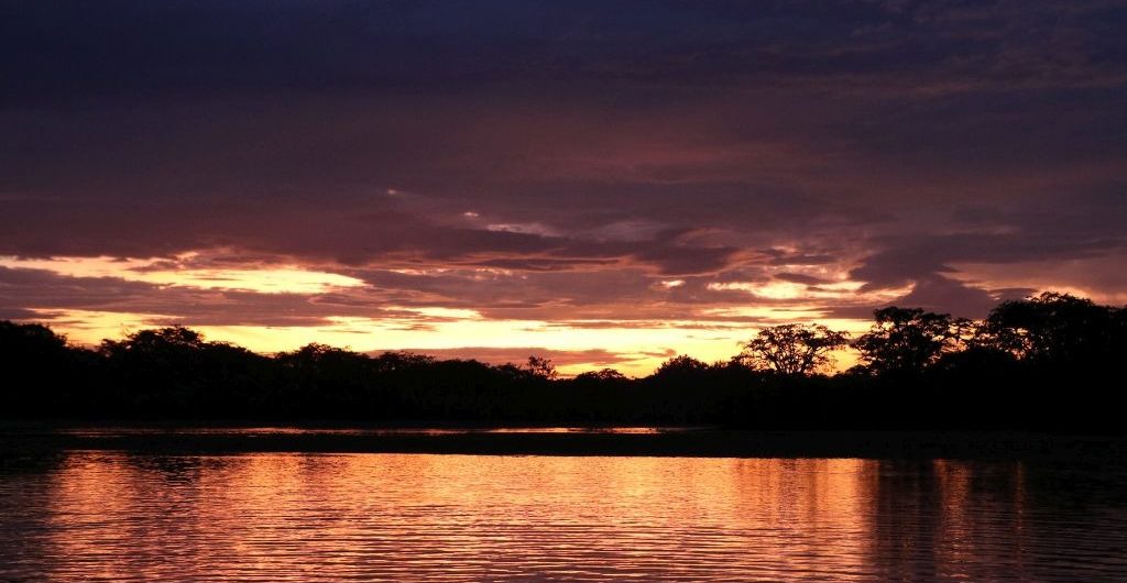
The Amazon river is 6,470 km (4,020 miles) long and the world’s longest and largest river. It is the creator of life, illusions and legends, and discovered by Francisco de Orellana in 1541.
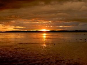
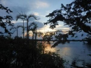
 Navigating its waters is getting in direct contact with the nature and lore of the natives that live there, it is watching the sun setting behind the treetops and marveling at the endless greenery. The Amazon is an immense slow moving river, at times almost like an ocean, as at certain points it can reach up to 4,000 meters in width. Its waters receive the outflow of all the rivers rising on the eastern slopes of the Andes, forming swamps, marshes and labyrinthine channels.
The ancient peoples of the Peruvian jungle, which has an area of more than 80 million square hectares and is home to countless animal species, call the Amazon River, Paranaguasú (Great River), Paranatinga (White River) and Tunguragua (King of the Waters). It is also claimed that the name is the result of a combination of two native words, ama (break) and zona (canoe); thus Amazon could mean “Canoe-Breaker” or Amazon (female) Warior.
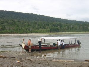
Many towns and villages have formed along the banks of the Amazon; the most important being Iquitos, capital of the department of Loreto.
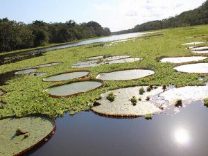
The waters around Iquitos are know for the great possibility of seeing the pink/ white sweet water dolphin, the grey dolphin and the enormous Victoria water lilies.
Victoria is a genus of water lilies, in the plant family Nymphaeaceae, with very large green leaves that float on the water’s surface. Victoria amazonica has a leaf that is up to 3 m (9.8 ft) in diameter, on a stalk 7–8 m (22.9-26.2 ft) in length. The genus name was given in honor of Queen Victoria of the United Kingdom.
The Amazon Basin itselve has the longest extension of rainforest in the world and is considered a patrimony of humanity by UNESCO due to the biological diversity it contains. The beauty of this areas, as well its biological richness, have made of Peru a destiny for wildlife researchers and nature lovers.
In 1982, the Peruvian Government established the Pacaya Samiria National Reserve with the purpose of preserving the wilderness resources and the beautiful landscapes of the area. The Reserve has an area of 8,042 square miles, which represents 1.5% of the total surface of Peru and is located at 180 Km. (115 miles) of Iquitos.
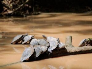
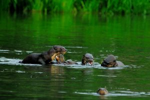
The name of Pacaya Samiria comes from the names of two rivers that run through it: Pacaya and Samiria. The Reserve has a great diversity of wildlife as well as aquatic life: 449 bird species, 102 mammals, 69 reptiles, 58 amphibians, 256 fish and 1,204 plants. Threatened or endangered species that can be found in the Pacaya Samiria National Reserve are the jaguar (Felix oca), the black alligator (Melanosuchus niger), the giant river otter (Pteronura brasiliensis), the manati (Trichechus inunquis), four different species of primates and two different species of turtles.
An essential element that is characteristic of this protected area, is the cycle of crescent and reflux of the rivers.
 Between the months of October and April is the rainy season and the water of the rivers and creeks increases, flooding a large area of the rainforest. This time is known as crescent. Reflux takes place between May and September, when rain decreases greatly and the level of the water falls progressively, reaching its minimum in August. This seasonal change and the predominantly flat terrain have configured a landscape full of small rivers, creeks and lagoons.
Wildlife adapts with no problem to this cycle of crescent and reflux and so, when most of the rainforest remains flooded, animals find shelter in the highest areas, where water never reaches.
During the reflux, when water is retained in small lakes and creeks, you can observe a large number of aquatic birds catching fishes which are concentrated there. During this time, large beaches are also formed specially in the main rivers, which are used by the settlers of the Reserve to grow rice, beans, peanuts, and other crops, and also by two very characteristic species of the Reserve, the “charapa” (Podocnemis expansa) and “taricaya” (Podocnemis unifilis) acquatic turtles, which use these beaches to lay their eggs.
In Pacaya Samiria, the great extension of rainforest remains flooded most of the year, with local species like the “aguaje”, a palm tree (Mauritia flexuosa) whose fruits are eaten by many animals as well as by settlers of local communities. There are other numerous varieties of flora that make the landscape of the Reserve unique in this part of the Amazon. We can also find a great diversity of medicine plants and trees that can reach a height of 150 feet, like the “lupuna” (Ceiba pentandra). In certain areas, you can still find rubber trees which preserve the marks of the famous rubber exploitation over 80 years ago.
 The wildlife of the Reserve is typical of the flooded rainforest, being more abundant the aquatic species rather than land ones. Fish is considered the most important resource due to its role in the ecological process as well as its economic value, and it is also a priority in the nutrition of the local people. There is an extensive variety of birds, specially the aquatic ones like the heron (Egretta thula) and cormorant (Phalacrocorax brasilianus). During the time of crescent, the high areas or “restingas” are the places for shelter and nourishment for mammals.
It is worth mentioning the “charapa” and “taricaya” aquatic turtles, which are considered endangered species. In order to prevent any illegal gathering, between the months of July and December, authorities of the Pacaya Samiria National Reserve are responsible for the gathering of the eggs that the turtles deposit in the banks of the rivers allowing these eggs the proper incubation time and a better chance of survival for the little turtles. Also, the “paiche” (Arapaima gigas), one of the biggest fresh-water fish in the world, that can reach up to eight feet long. The demand for its exquisite meat has developed in an abuse for its hunting.
The Pacaya Samiria National Reserve is part of the National System of Natural Areas and is protected by the Peruvian Government. Its administration is in hands of INRENA (National Institute of Natural Resources) which has offices in Lima and Iquitos. According to the Master Plan for the Conservation of the Biological Diversity and Sustainable Development of the Pacaya Samiria National Reserve, tourists have access only to determined zones of the Reserve -previous payment of an entrance fee.
In the Pacaya Samiria National Reserve there are 94 communities, 21 of them of the Cocama – Cocamilla ethnic group. The total population of the Reserve is 42,000 people and their main economic activities are centered around fishing, agriculture, gathering and hunting, being the first, their most important activity and main source of food. The closest towns to the Reserve are Nauta and Requena.
The Tambopata (Candamo) National Reserve
 Tambopata National Reserve (formerly only known as the Tambopata-Candamo Reserved Zone) is a nature reserve in the Peruvian Amazon Basin south of the Madre de Dios River in Tambopata Province’s Inambari and Tambopata districts. It has a surface area of 1,478,942 hectares (3,654,550 acres). It was created on January 26, 1990, to protect the watersheds of the rivers Tambopata, Candamo and Heath, that have two important ecosystems and are noted for its biodiversity, representing native flora and fauna with 165 species and 41 families of trees, 103 species of mammals, 1300 species of butterflies and 90 species of amphibians.
Note: Most Jungle Lodges are NOT situated in the new less accessible part of the Tambopata Reserve, The Reserved Zone or. To give a better protection to this Zone, there are only a limited amount of lodges and visitors allowed in the area, best known as: Tambopata Research Center.
The Tambopata National Reserve is adjacent to the huge 1 million hectare Bahuaja Sonene National Park. Whilst the Tambopata National Reserve was created with an underlying philosophy of sustainable resource use, the park was created with the purpose of wholeheartedly protecting the forests within. Both conservation units protect some of the last untouched lowland and premontane tropical humid forests in the Amazon. This Connecticut-sized area of pristine forest contains 600 bird species, 32 parrot species (10% of the world’s total), 200 mammal species, 1200 butterfly species and over 10,000 species of vascular plants.
The Tambopata National Reserve is located across the regions of Madre de Dios and Puno:
• Tambopata is the 40% of the reserve in the department of Madre de Dios.
• Carabaya and Sandia are the 60% of the reserve in the department of Puno.
Geography:
The protected area features eight life zones: subtropical humid forest, tropical humid forest, subtropical high-humidity forest, subtropical high-humidity foothills cloud forest, subtropical rainforest, tropical cloud forest foothills, subtropical lower foothills cloud forest and semi-flooded subtropical cloud forest.
Average annual temperature is 26°C, ranging from 10-38°C; with average annual rainfall of 1600–2400 mm. Rainfall in the protected area is typical of most areas in the Peruvian Amazon. The climate is humid and (3000 mm and 25°C on average), sub-level humidity and semi-warm (1700 mm and 26°C on average), high-level semi-warm (4000 mm and 23°C).
Access is from Puerto Maldonado, where one can get to the preserve via the Tambopata River; or by car via the Puerto Maldonado–Cuzco
 Both the Tambopata National Reserve and the Bahuaja-Sonene National Park form part of the titanic 30 million hectare Vilcabamba-Amboro Conservation Corridor.
The corridor is formed by 16 protected areas ranging from the Vilcabamba mountain range west of Cusco to the Amboro National Park in central Bolivia, and include Manu National Park, the Machu Picchu Historical Sanctuary and the Madidi National Park, among others. In addition, this corridor protects over 40 ethnic groups. Its objective is to spur the region’s development through participatory planning for the strengthening of local organizations, sustainable small businesses and agro-forestry in order to minimize the loss of biodiversity.
The jungle lodges are a small part of the network of organizations and communities that are attempting to protect this amazing wilderness by creating and sharing the value of leaving the forest standing.
History:
A conservation process in the Tambopata Province (Madre de Dios), was initiated in Tambopata where a group of naturalists and biologist proposed the conservation of 10,000 hectares of rainforests in the middle Tambopata River (January 3, 1977). This was established as “Zona Reservada Tambopata”(ZRT), in the territory of the traditional tribe Ese´eja. It was created for the conservation of the Amazon forest and for scientific research; as well as for tourism. In July of 1977, the government had an arrangement with the Peruvian Safaris, owner of Explorer´s Inn. This operator got an agreement to explore sustainable tourism opportunities in the area.
In 1983, the Santuario Nacional Pampas Del Heath (SNPH) was established, with a superface area of 105.957 hectares (261.83 acres). The purpose was to protect the unique territory of “Sabana Húmeda Tropical” in Peru.
By the 1986s, a Peruvian conservation NGO Selva Sur (ACSS) and a senior Wildlife Conservation Society biologist (C. A. Munn) organized two biological expeditions to the Upper Tambopata and Heath River to propose a larger conservation area, as soon as oil exploration stopped and temporarily abandoned the region. At that time, Peru´s development bank system became in bankrupcy, then more ambitious plans to develop the Amazon forests in Madre de Dios, by means of cattle ranching, gold mining, poor yielding agricultural production, and other slash-and-burning schemes, no longer pressured large extensions of rainforests. Neotropical biologists such as A. Gentry, T. A. Parker, C. Munn, among others suggested to ACSS to further explore the Upper Heath River, since teams of Bolivian and USA biologists were already interested in preserving the Upper Madidi area in Bolivia, right next to the Heath River in the Peruvian and Bolivian border, considering the possible establishment of a bi-national park for which they have already overflew the region and started field research.
 After two expeditions in 1986 and 1987, and several visits to the Tambopata and Heath rivers, a new draft entitled Propuesta de Zona Reservada Tambopata Candamo was submitted to the DGFF Lima by Selva Sur (ACSS) in 1987. This proposal, led by Peruvian conservationists (D.G.Ricalde) included over 1.5 million hectares, including the proposed ZRT (presented by Explorer´s Inn manager T. Gunther and several UK biologists), and excluding indigenous territories already entitled whose territories should not be affected but consolidated under the new proposal. According to the Director General Forestal y Fauna Silvestre (M.Pastor), a debt-swap for nature project was suggested to help the establishment of a new larger conservation area. Unfortunately, the debt-swapt for nature approach did not worked out. In 1988, the DGFF reconsidered the larger ZRTC proposal, as Lima´s reps from the Ministerio de Agricultura were preparing an international summit to discuss and profile Peru´s National Forestry Strategy (1989), that should include conservation and forestry projects to be potentially funded. The main objective of the proposed ZRTC was to combine agricultural and forestry schemes along the road Puerto Maldonado- Cusco to help mitigate the future impact of the Carretera Binacional, to consolidate indigenous territories, also the establishment of ecotourism areas to save unique wildlife attractions, and protection/conservation areas where healthy territories for Amazon wildlife such as the jaguar and other wild cats, giant otter, over 10 monkey species, black caiman,over 400 bird species, and thousands hectares of rainforests probably containing the richest botanical diversity found in the Amazon, according to researchers and observers.
In 1990, thanks to the effort of the government to protect the biodiversity, and lobbying from ACSS (E.Ráez-Luna, J. Oviedo and others) it was named as ZRTC. Tambopata Candamo was officially created on January 26, 1990, as an initiative of the Peruvian government following recommendations from Peruvian and international researchers.
This proposition was elaborated in the background of the “Conservation of the Tropical Ecosystems Project and the sustainable use of the natural resources inside the Candamo Tambopata Reserve Area”. Also, a damp area of the Tambopata National Reserve was determined as the Bahuaja Sonene National Park, formed by 271,582 hectares exclusive of the Tambopata – Candamo Reserve.
Population:
 Less than 5000 people (equivalent to a minor league sports event) inhabit the Tambopata National Reserve’s “area of influence” to the north. Most of them make a living of slash and burn agriculture, small scale gold mining, timber extraction, and hunting and fishing.
There is a tribe of about a thousand people called the ‘Esse’eja’ o ‘huarayos’ that live in the reserve, in four titled communities within this area of influence. They live next to the quechuas and aymaras and have activities such as agriculture (coffee), hunting, fishing and foraging.
The poor presence of humans had done a wonderful conservation of different ecosystems. There are so many species that surprise any scientist: 1,234 types of different butterflies, 592 of birds, 127 of amphibians, 103 of mammals, 74 reptiles and a lot of varieties.
The undergoing pavement of the Inter-Oceanic highway, joining Brazil’s north Atlantic coast with Peru’s Pacific Coast and access to the Asian markets now presents the principal threat over the midterm to this region’s incomparable wilderness.
Flora:
The Tambopata River is one of the exclusive habitat of birds and mammals. Flora in the national reserve is fairly typical of the southwest Amazon Basin. The Heath River and surrounding plains are a unique ecosystem in Peru. The pampas are periodically flooded, and small groves of trees with varied plant life grow in isolated clumps on the plain.
The protected area is home of a wide diversity of plants, including exploited forest species such as cedar, mahogany, tornillo, Brazil nut, palm trees such as the pona, aguaje, huasaí and ungurahui.
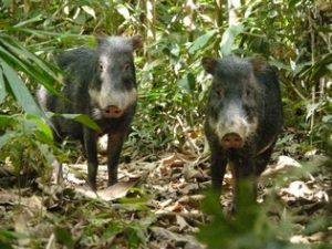
Researchers have discovered in the protected area large numbers of species that are now rarely found elsewhere in the Amazon jungle due to poaching, particularly tapirs and spider monkeys, but also jaguars, white-lipped peccary, medium-sized and large monkeys and caiman.
Within the reserve, the lower elevation zone is dominated mostly by Amazonian bird species, the ones that are at or near their upper elevation limits, and by species that are restricted (or partially restricted) to the narrow band of rain forest found on the lower slopes of the Andes. Because of the growing deforestation rate along this latitudinal border in other parts of the Andes, this ecosystem is one of these most threatened in all of South America. A relatively large portion of this ecosystem is found within the Bahuaja-Sonene National Park.
Rainy season From November to April. » From May to October … From July to September is the best season to observe macaws.
Observations from a guest:
If you’re visiting the Amazon, don’t stop without putting in the extra effort to get to Tambopata Research Center (TRC)! It takes an extra day to arrive because it’s an additional four hours upstream beyond Refugio Amazonas, but well worth it. The first night is spent at Refugio Amazonas, with guided tours of the area jungle. I saw lots of unique birds and insects (tarantulas, etc). But the real eye-openers didn’t happen until arriving at TRC the following day. Because it’s so much futher in the jungle, with less human intrusion, brightly-colored macaws were a common occurrance. During the 4-day visit, we spotted howler monkeys, spider monkeys, saddleback tamarins, and really cute squirrel monkeys! There were a couple scarlet macaws which visited the guest rooms and breakfast area every day. (Keep any food locked up!). The rooms are rustic, but in a good way which is fitting for the environment. The exterior wall to the room is completely open to the outside, allowing you to wake up with the view of macaws flying around!
Animals species seen from Explore Inn in The Tambopata Reserve area in October 2011:
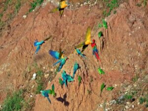
From the Collpita Clay Lick: Blue-headed Parrot (Pionus menstruus), Chestnut-fronted Macaw (Ara severa), Dusky-headed Parakeet (Aratinga weddellii), Mealy Parrot (Amazona farinosa) and Yellow-crowned Parrot (Amazona ochrocephala)
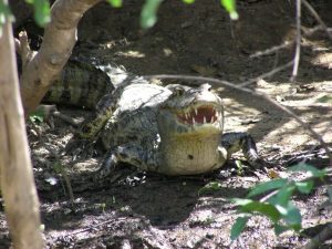
Caimans Tambopata Reserve:
• Caiman’s were monitored on 18th and 24th of October; all of which were Spectacled.
• 18th – 6 caiman seen between 19:05- 19:30; from 0.35 to 1.7m; cloudy.
• 24th – 6 caiman seen between 18:35- 18:56; from 0.4 to 1.5m; cloudy.
The following rare species were seen in the month of October 2011:
 Date Species seen Trail
03/10/11 Tapir Heliconia
18/10/11 Nine-banded armadillo Tambopata
19/10/11 Tayra Tapir 1100
19/10/11 Blue Throated Piping Guan Collpita
20/10/11 Braziian Porcupine Lodge
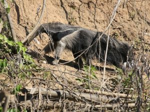
22/10/11 Giant anteater Main 1000m
24/10/11 Agami Heron Cocococha
28/10/11 Rainbow Boa Sunset 150m
28/10/11 Ringed Coral Snake New Collpita 700m
28/10/11 Night Monkeys Sunset point 200m
28/10/11 Ringed Coral Snake New Collpita 700m
29/10/11 Red Brocket Deer Tapir 2000m
30/10/11 Coati Ant 300m
30/10/11 Kinkajou Ant 450m
30/10/11 Tamandua Main 3000m+
30/10/11 White Lipped Peccary Main 1100m
Info from Tambopata Research Center about the Colpa Colorado Clay Lick:
• The daily weather has a strong influence on the number of parrots that use the lick: least on rainy days and the most on clear sunny days.
• The seasonal climate changes drive the fluctuations in the annual food supply for parrots and macaws (flowers, unripe fruits and ripe fruits). Food availability is apparently lowest at the end of the wet season and early dry season (March – July) and highest in the early to mid wet season December and January.
• The annual fluctuations in food supply drive two things: the annual movements of parrots to and from the area around Tambopata Research Center and the time they breed.
o During the seasons of lowest food availability the birds apparently leave the area around TRC as the number of birds in the forest drops dramatically from April – July.
o The timing of breeding is apparently driven by the food supply: the number of parrot species breeding is closely correlated with the number of trees in fruit or flower. However, not all species breed simultaneously. Smaller species apparently breed earlier than larger ones.
Manú National Park
The Manú National Park is a biosphere reserve located in Madre de Dios and Paucartambo, Cusco. Before becoming an area protected by the Peruvian government, the Manú National Park was conserved thanks to its inaccessibility. The park remains fairly inaccessible by road to this day. In 1977, UNESCO recognised it as a Biosphere Reserve and in 1987, it was pronounced a World Heritage Site. It is the largest National Park in Peru, covering an area of 15,328 km². The Biosphere Reserve includes an additional 2,570 km², and a further 914 km² are included in a “Cultural Zone” (which also is afforded a level of protection), bringing the total area up to 18,811 km².
 The park protects several ecological zones ranging from as low as 150 meters above sea level in parts of the Southwest Amazon moist forests to Peruvian Yungas at middle elevations to Central Andean wet puna at altitudes of 4200 meters. Because of this topographical range, it has one of highest levels of biodiversity of any park in the world. Overall, more than 15,000 species of plants are found in Manú, and up to 250 varieties of trees have been found in a single hectare. The reserve is a destination for birdwatchers from all over the world, as it is home to over 1000 species of birds, more than the number of bird species found in the United States and Canada combined. It is also acclaimed as having one of the highest abundances of land vertebrates ever found in Latin American tropical forests.
The park encompasses virtually the entire watershed of the Manú River, from the sources of its tributaries high in the Andes, to its emptying into the Madre de Dios River. As the surrounding area is largely undeveloped, the only direct access to the lowlands is by boat, up the Manú River. This singular entry point is easily patrolled by park guards. The road Cusco-Paucartambo-Shintuya borders the southern section of the park and provides access to high-Andean ecosystems, such as grasslands (puna) and montane forest and scrub.
Flora:
More than 20,000 species. 40% of the park is Amazonian lowland tropical rainforest, including varzea, oxbow lakes, Iriartea palm swamps, and upland forest types.
Fauna:
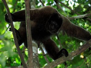
 The Manú Biosphere Reserve has a very rich wildlife. Larger species of the lowland forests include jaguar, puma, ocelot, giant otter, giant anteater, southern tamandua, giant armadillo, nine-banded armadillo, brown-throated sloth, Hoffmann’s two-toed sloth, Brazilian tapir, capybara, pacarana, Wild Tayra , Andean cock-of-the-rock, lowland paca, collared peccary, white-lipped peccary and several deer species, like South American red brocket, and South American brown brocket. The marsh deer, actually rather a savannna animal, has also been confirmed. There are 14 species of monkeys. These are Goeldi’s marmoset, pygmy marmoset, shock-headed capuchin (Cebus albifrons cuscinus), tufted capuchin (Cebus apella peruanus), Brown-mantled tamarin, emperor tamarin, moustached tamarin, black-capped squirrel monkey, black-headed night monkey, brown titi, Rio Tapajós saki, Bolivian red howler, Peruvian spider monkey, and gray woolly monkey. Confined to the mountainous areas above ca. 2000 m are Peruvian white-tailed deer, dwarf brocket, culpeo, mountain paca and spectacled bear. The puma also reaches very high elevations of up to 3450 m.[3]
• Mammals : 222 species
• Reptiles : 99 species
• Amphibians : 140 species
• Birds : 1000 species
• Fish : 210 species
• Insects (numerous undescribed species not included)
o Butterflies : 1307 species
o Ants : 300 species
o Dragonflies : 136 species
o Beetles : 650 species
Most of this rain falls from the end of November through beginning of April. The dry months of the year are from June to September.
Humans in the park:
Permanent human habitation is restricted to several small communities of the Matsigenga Amazonian tribal group, largely along the Manú river or one of its main tributaries. Several protected areas adjoining the park allow mixed use including tourism, hunting, logging, and harvesting of other resources. These areas, notably downstream on the Manú River, are included in the broader Manú biosphere reserve, but are not part of the national park.
Visitors within the national park include medical and educational professionals upon invitation by the indigenous community, and researchers with permits from INRENA. The Cocha Cashu Biological Station, under the guidance of renowned Duke University ecologist John Terborgh is the largest and most established research site in the park, and is among the most well-studied sites for biological and ecological research in the tropics.
The Manu Learning Centre (MLC) lies within the Cultural Zone of the Manu Biosphere Reserve along the South-Eastern border with the Alto Madre de Dios River. The MLC facilitates research work within the disturbed ‘buffer’ zone of the park where human impact is at its greatest.
Additional info:
Approximately half the area of Switzerland, the Manu Biosphere is a complete ecosystem with protected watershed embracing Andean montane cloud forest, tropical lowland forest and the Alto Madre de Dios and Manu river drainage systems. The biosphere itself is subdivided into national park and two adjacent zones, one for tourism and the other for cultural subsistence. It is home to over 1000 species of birds, 15,000 species of plants, over 200 species of mammals, and untold numbers of insects, and within its heart remain yet uncontacted peoples.
Manu retains healthy populations of jaguar, tapir, anteater, black caiman, giant otter, and among the 13 species of monkey we find the unique pigmy marmoset, the smallest monkey in the world, and the nocturnal night monkey. Because of Manu’s low human population and their continued use of traditional hunting techniques, the animals in the park show little fear of man and are more readily approachable than in many other rainforest locations. Manu, therefore, offers unparalleled animal watching opportunities.
Wildlife aside, however, the journey into the park itself is amazingly spectacular and not to be missed. Access to Manu is normally by road from Cusco, Peru. The two day trip from Cusco to the entrance of the Manu Reserved Zone carries you over the Peruvian Andes mountains to an elevation of 4000 m, past pre-inca ruins and down through the cloud forest on the eastern side of the Andes, and finally into lush, lowland rainforest. Roads remain largely unpaved and wind their way precariously past cascading waterfalls, deep gorges, and precipices. Manu is truly a complete experience.
Comment from a visitor: 
On our way to Pantiacolla lodge, we stopped at a village where the indigenous tribe showed us how to shoot their huge bows, demonstrated bird & animal calls, & the children put on a dance show. It was a tad long but we all enjoyed it.
As I said, we did see a lot of wildlife. We saw 94 types of birds, including dozens of macaws, parrots, parakeets, Wood Storks, a Roseate Spoonbill ( highly unusual for this time of year), many black & white caimans, giant otters, 6 species of monkeys and going up the beach in the distance, a jaguar. We also saw numerous types of snakes, including highly poisonous ones. Oh, and a poison dart frog. If you are interested in wildlife viewing, Manu is the place to go.
Our guide led us two night hikes, which I declined, but were very interesting to those who participated. It was enough for me to get up at night to go to the bathroom, checking carefully for snakes in the corners &/or frogs in the toilets (which I did find).
The accomodations were of varied quality, all rustic & some VERY rustic. Privacy is at a minimum. We had hot showers one day, but since it was so hot, no one really cared if the water was hot.
 We did enjoy our hours in the boat, watching the banks for new bird & animal species. Being woken up in the early morning by howler monkeys is an amazing experience none of us will ever forget. Seeing the parrots & macaws gathering at the claylick was amazing!
I would have liked to have seen more mammals & fewer reptiles.
Cuyabeno Wildlife Reserve
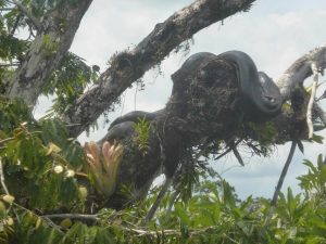
The Cuyabeno Wildlife Reserve (Spanish: Reserva de Producción Faunística Cuyabeno) is a humid tropical rainforest protected zone in Ecuador. It is situated in the Putumayo Canton in the Sucumbíos Province and in the Aguarico Canton in the Orellana Province. It was founded on 26 July 1979. At an altitude of 200– 280 meters, one of the principle objectives of the 6,033.8 square kilometres (2,329.7 sq mi) Cuyabeno Reserve is ongoing conservation of the complex Amazonian ecosystem. The reserve is a complex of rivers, lagoons and floated forest. The protected area is characterized by its high biodiversity and interaction and cooperation between the species inhabiting the area. Its geomorphology is a consequence of the rivers carrying sediment and materials from the Andes, principally by Aguarico River, which is considered as white water due to the sediment it drags raising water levels and therefore ensuring that the river is navigable all year round. It is considered to be one of the most biodiverse sites in the world together with the neighboring Yasuni National Park.
 Cuyabeno is a place of great biodiversity, home of one the greatest wildlife concentration places in the world, both flora and fauna-wise. It is a complex system of rainy formations, 13 small lakes, rivers and tropical wild forests turning this 1,500,000 acres (6,100 km2) into a record of highest level of biodiversity in the world.
Within the tropical rain forest vegetation, there is a rich variety of plants such as palms, bromeliads, Ceibos, heliconia, Macrolobium, wild roses and 60 different orchid species. 12000 different plants have been approximately found inside the wildlife reserve. Many are used by the native Indians medically.
Cuyabeno keeps more than 550 different bird species, more than 350 fish species, including piranhas; a great variety of reptiles such as anacondas, alligators and river turtles. Frequently observed species include various species birds, such as colorful parrots, kingfishers and hoatzins or Amazon eagle, which flaunts its 8-foot (2.4 m)-wide wingspan, and lots of varieties of beetles and poisonous dart frogs as well. Amongst the mammals, the tapir (Tapirus terrestris), freshwater pink dolphins and armadillos can be found.
Because this wildlife reserve belongs to the National Protected Areas System, very few tour operators are qualified to work in this zone. This is why not so many tourists can be found visiting this zone, making it more attractive to enjoy the nature and its magnificent sounds.
Fauna: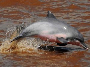
The Cuyabeno reserve is particularly known for its wildlife. Creatures like tapirs, ocelots, bats, jaguars, pumas, capybaras, anacondas, anteaters peccaries, poison dart frogs, agoutis, iguanas and fifteen different species of monkey can be found roaming the extensive lands of the reserve. Swimming through the waters are turtles, pink freshwater dolphins, giant otters, manatees (use to be frequent, but are now very rare seen), five species of caiman and nearly five hundred different species of fish—including the famous piranha. And don’t forget about the over five hundred different bird species that make the reserve one of the best places on the planet for bird watching. Keep your eyes peeled for colorful Woodpeckers, Hummingbirds, Tanagers, Macaws, Toucans and even the Harpy Eagle!.
The river system covers the rivers Aguarico, San Miguel and Cuyabeno and their tributaries.
Limited rainfall records indicate an annual mean precipitation of about 3,000 mm; with more than 250 mm of monthly rainfall during the rainy season (from mid-March through August) and less than 250 mm during the dry season (from Mid December through the first days of March).
Along the Cuyabeno is a system of 14 black-water lagoons, which during raining season are formed by floods. They are typical of the rainy season, but shrink a lot during the dry season. From December to March they might even dry almost out. During this period access to the lake is very unreliable and only special expeditions may be organized into the lakes, as access often may only be on foot.
During the dry period, the lake area is extremely beautiful and wildlife often is concentrated in great numbers around the last remaining puddles and pool in the drained lakes. Many birds have their breeding season during that period.
Visitors to the region will be stunned by the remoteness of it. The jungle appears as a thick, dense mass of green laced and interwoven by powerful rivers and trickling streams. Life is all around you at the Cuyabeno reserve, as you’ll notice that it’s never quiet here. You can always hear something buzzing, chirping, howling or hooting. Green is without a doubt the dominant color, but the longer you spend at the park, the more you will begin to notice the brilliant flashes of color produced by the many exotic flowers, birds and insects.
Visitors to the area should also be prepared to get wet, and not just from the torrential rains and overflowing rivers. The humidity level is typically between 90 and 100%, making for some very sticky conditions. Be sure to pack breathable clothing and plastic casing for any electronics or valuable goods.
From a visitor: of the Cuyabeno Reserve (Seen in June 2011):
 In the area of Laguna Grande. We were very lucky and the amount of animals we saw today was amazing. We were aware that it if often difficult to spot wildlife because of the dense vegetation. But we quickly learned that traveling along the river allows you to see a lot more because the canopy is a little less dense.
The trip as a whole was amazing but it got better with every river bend we rounded. Our guide kept putting point values on everything we saw. But it got to a point that even our guide couldn’t believe our luck. By then end he said the only thing left to see was a jaguar. Unfortunately we did not get to see one of those but at no point was I disappointed.
A Baby Anaconda that we saw on the first boat trip. You can tell it was a baby because its only about 6ft long; A Spider monkey jumping from tree to tree. We saw the spider monkeys a couple of times; Squirrel Monkeys; Black headed parrot that we sat above us during lunch. Not the right season for parrots but cool to manage to see one.
Black bushy tailed monkeys, Hoatzin also known as the stink bird because they smell bad. We were not close enough to smell them.
A black headed snake, We managed to see river dolphins as well but unfortunately they did not cooperate with the camera. We were also told that there used to be manatees in the rivers, but they were near extinction because of boat traffic. Last but not least we saw a sloth. Not only was he moving but he was eating!
Yasuni National Park
Yasuni National Park is in Ecuador with an area of 9,820 km2 between the Napo and Curaray rivers in Napo and Pastaza provinces in Amazonian Ecuador. The park is about 250 km from Quito and was designated a UNESCO Biosphere Reserve in 1989. It is within the claimed ancestral territory of the Huaorani indigenous people.
Yasuni is home to several uncontacted indigenous tribes, including the Tagaeri and the Taromenane.
The national park lies within the Napo moist forests ecoregion and is primarily rain forest.
Yasuni National Park is arguably the most biologically diverse spot on Earth. The park is at the center of a small zone where amphibian, bird, mammal, and vascular plant diversity all reach their maximum levels within the Western Hemisphere. Moreover, the park breaks world records for local-scale (less than 100 km2) tree, amphibian, and bat species richness, and is one of the richest spots in the world for birds and mammals at local scales as well.
However, Yasuni National Park is threatened by oil extraction and the colonization, deforestation, illegal logging, and unsustainable hunting that accompanies oil-access routes.
A species of bat, Lophostoma yasuni, is endemic to the park.
August 18, 2010: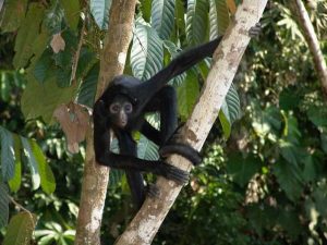
Under the unprecedented agreement, known as the Yasuni-ITT Initiative, the government of Ecuador will refrain from exploiting the Ishpingo-Tambococha-Tiputini oil field within the Amazon rainforest park
In this first-of-its kind agreement, Ecuador has pledged to not to develop the 850 million barrels of crude oil under Yasuni National Park for the next 10 years in return for $3.6 billion from the United Nations. The park is one of the most biodiverse expanses of rainforest in the world, a single hectare of which boasts more species of trees than in all of North America.
We hope that our information above has been helpful to you and that you you now have a better impression of which tour you would like to book. Please check out our special Amazon tour selections and feel free to ask any question you might still have.


Comments